Welcome to WebGeographia.com
webgeographia.com is a website that displays a few GIS (Geographic Information Systems) applications.
![]()
The logo
The logo of webgeographia.com symbolizes the spatial and informative components of GIS and it also reminds that this technology can be applied to any issue of our world, anywhere, and from anywhere.
A definition of GIS
GIS is defined as a computer system for capturing, storing, managing, and displaying geospatial data, which include coordinates (geographic or projected) in addition to their attributes.
The power of GIS
The combination of georeferenced geographic features and their attributes enables a quick query, analysis, and display of all types of data, both geographic and non geographic.
The two types of features/phenomena, discrete, that have well defined shapes and location, and continuous, that vary continuously over space,
are handled respectively by the vector data model and the raster data model by .
Spatial features are represented by points, lines, or polygons in the vector data model, while continuous phenomena are represented as regular grid in the
raster data model.
An attribute table is linked to each geometric feature in the vector data model, while values in each grid cell measure the intensity of phenomena in the raster data model.
An example of WebGIS
Below is an example of point features (indicated by the green pushpins) with their attributes that appear by clicking on the pushpins.
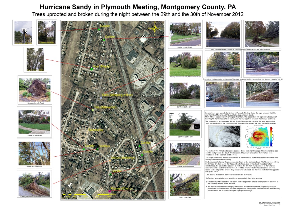
Trees uprooted by Hurricane Sandy in Plymouth Meeting, PA, on October 2012: